


Illustrated (see end of article) with 26 photographs by Santha Faiia shot on location at Gobekli Tepe in September 2013 and at Gunung Padang in December 2013
“Everything we’ve been taught about the origins of civilization may be wrong,” says Danny Natawidjaja, PhD, senior geologist with the Research Centre for Geotechnology at the Indonesian Institute of Sciences. “Old stories about Atlantis and other a great lost civilizations of prehistory, long dismissed as myths by archaeologists, look set to be proved true.”
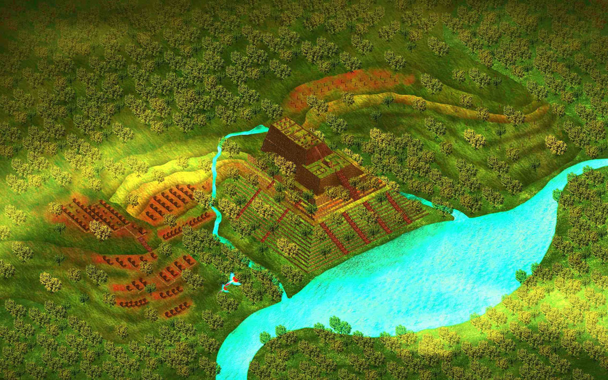
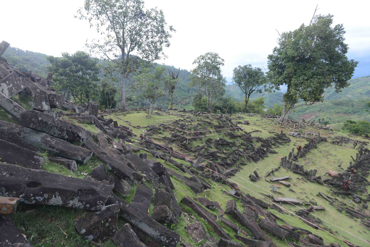
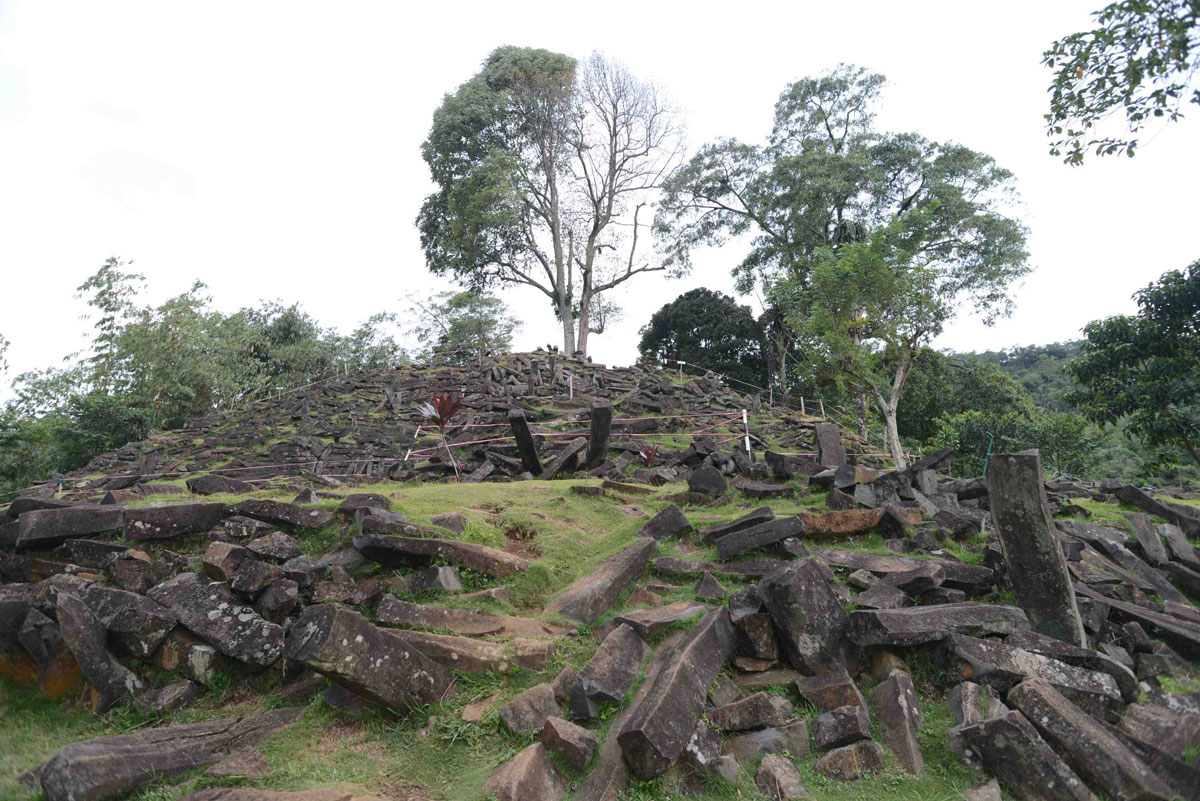
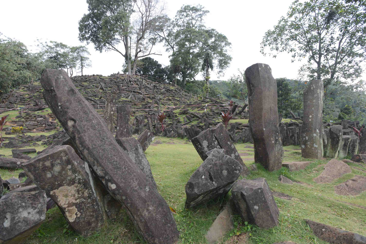
I’m climbing with Dr Natawidjaja up the steep slope of a 300-ft high step-pyramid set amidst a magical landscape of volcanoes, mountains and jungles interspersed with paddy fields and tea plantations a hundred miles from the city of Bandung in West Java, Indonesia.
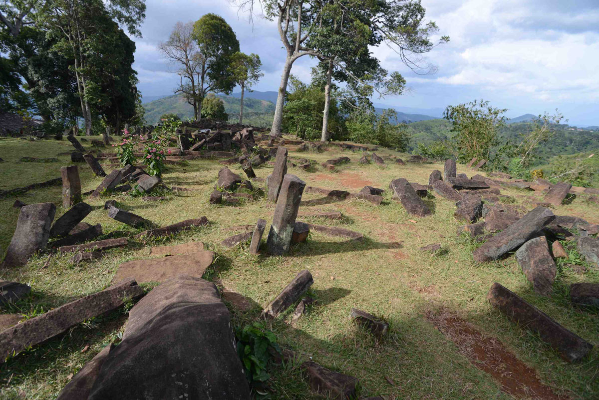
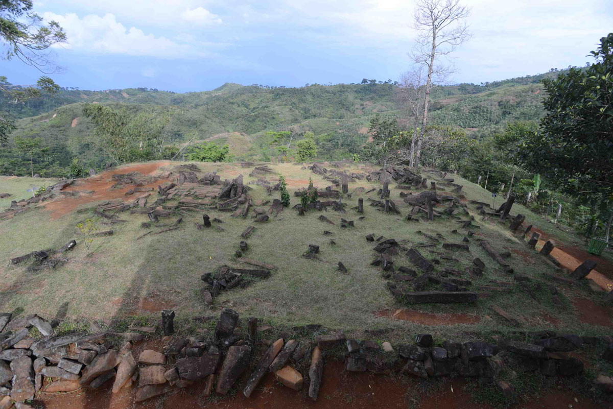
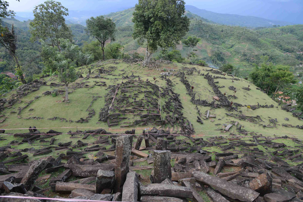
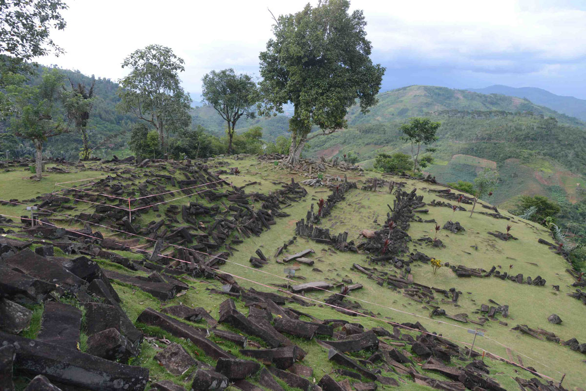
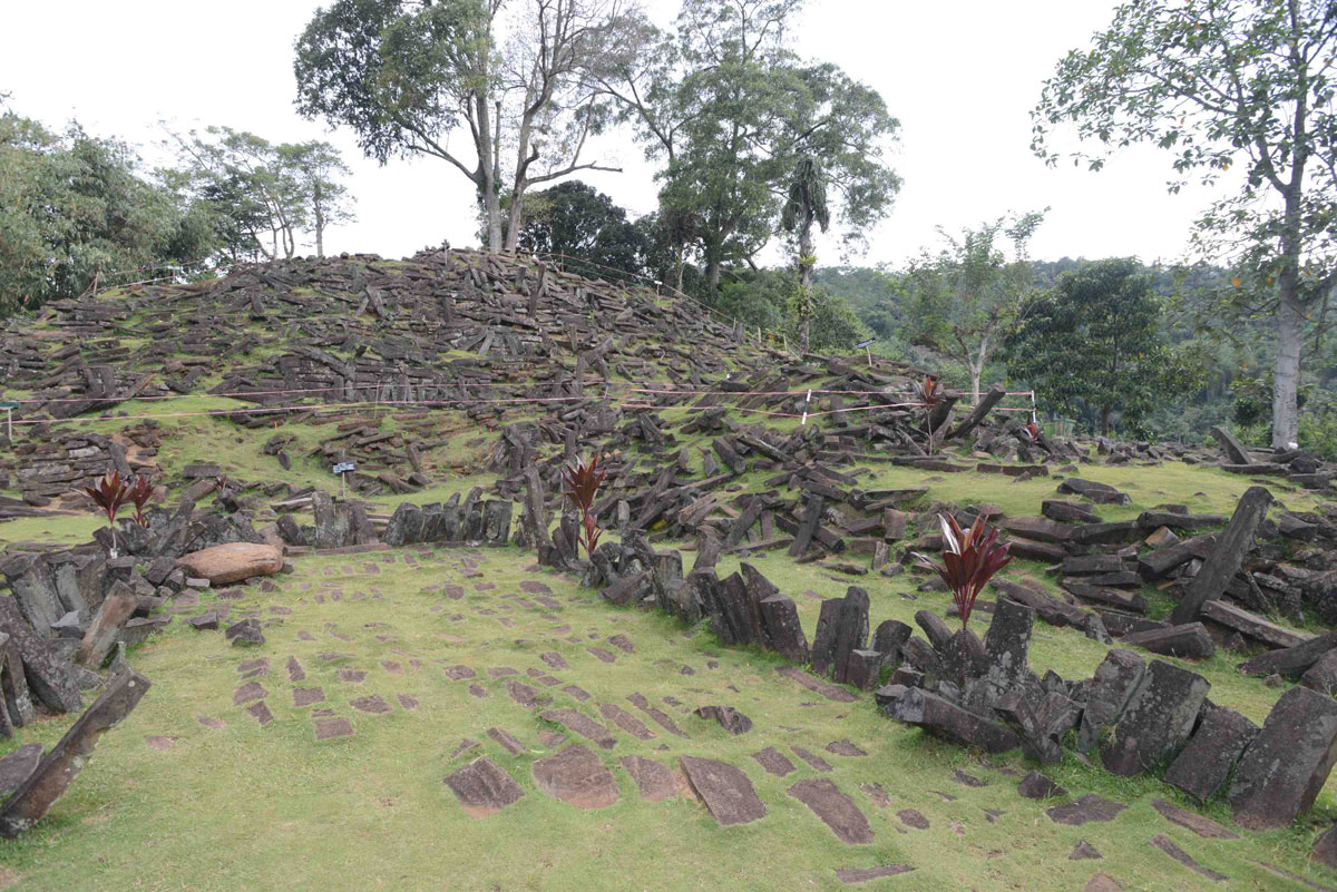
The pyramid has been known to archaeology since 1914 when megalithic structures formed from blocks of columnar basalt were found scattered amongst the dense trees and undergrowth that then covered its summit. Local people held the site to be sacred and called it Gunung Padang, the name it still goes by today, which means “Mountain of Light”, or “Mountain of Enlightenment”, in the local Sundanese language. The summit, where the megaliths were found arranged across five terraces had been used as a place of meditation and retreat since time immemorial, archaeologists were told, and again this remains true today.
However neither the archaeologists, nor apparently the locals realized the pyramid was a pyramid. It was believed to be a natural hill, somewhat modified by human activity, until Natawidjaja and his team began a geological survey here in 2011. By then the summit had long since been cleared and the megalithic terraces recognized to be ancient and man-made, but no radiocarbon dating was ever done and the previously accepted age of the site – about 1,500 to 2,500 BC — was based on guesswork rather than on excavations.
The first scientific radiocarbon dating was done by Natawidjaja himself on soils underlying the megaliths at or near the surface. The dates produced – around 500 to 1,500 BC – were very close to the archaeological guesswork and caused no controversy. However a surprise was in store as Natawidjaja and his team extended their investigation using tubular drills that brought up cores of earth and stone from much deeper levels.
First the drill cores contained evidence – fragments of columnar basalt – that man-made megalithic structures lay far beneath the surface. Secondly the organic materials brought up in the drill cores began to yield older and older dates – 3,000 BC to 5,000 BC, then 9,600 BC as the drills bit deeper, then around 11,000 BC, then, 15,000 BC and finally at depths of 90 feet and more an astonishing sequence of dates of 20,000 BC to 22,000 BC and earlier.
“This was not at all what my colleagues in the world of archaeology expected or wanted to hear” says Natawidjaja, who earned his PhD at Cal Tech in the United States and who, it becomes apparent, regards archaeology as a thoroughly unscientific discipline.
The problem is that those dates from 9,600 BC and earlier belong to the period that archaeologists call the “Upper Palaeolithic” and take us back deep into the last Ice Age when Indonesia was not a series of islands as it is today but was part of a vast southeast Asian continent dubbed “Sundaland” by geologists.
Sea level was 400 feet lower then because huge ice caps two miles deep covered most of Europe and North America. But as the ice caps began to melt all the water stored in them returned to the oceans and sea-level rose, submerging many parts of the world where humans had previously lived. Thus Britain was joined to Europe during the Ice Age (there was no English Channel or North Sea). Likewise there was no Red Sea, no Persian Gulf, Sri Lanka was joined to southern India, Siberia was joined to Alaska, Australia was joined to New Guinea – and so on and so forth. It was during this epoch of sea-level rise, sometimes slow and continuous, sometimes rapid and cataclysmic, that the Ice Age continent of Sundaland was submerged with only the Malaysian Peninsula and the Indonesian islands as we know them today high enough to remain above water.
The established archaeological view of the state of human civilization until the end of the last Ice Age about 9,600 BC was that our ancestors were primitive hunter gatherers incapable of any form of civilization or architectural feats. In the following millennia settled agriculture was very gradually developed and perfected. Around 4,000 BC the increasing sophistication of economic and social structures, and growing organizational abilities, made possible the creation of the earliest megalithic sites (such as Gigantija on the Maltese island of Gozo for example) while the first true cities emerged around 3500 BC in Mesopotamia and soon afterwards in Egypt. In the British Isles Callanish in the Outer Hebrides and Avebury in southwest England, both dated to around 3,000 BC, are the oldest examples of true megalithic sites. The megalithic phase of Stonehenge is thought to have begun around 2,400 BC and to have continued to around 1,800 BC.
Within this well worked out and long-established chronology there is no place for any prehistoric civilization such as Atlantis. But interestingly the Greek philosopher Plato, whose dialogue of Timias and Critias contains the earliest surviving mention of the fabled sunken kingdom, dates the catastrophic destruction and submergence of Atlantis by floods and earthquakes to “9,000 years before the time of Solon” – i.e. to 9,600 BC, the end of the last Ice Age. Since the Greeks had no access to modern scientific knowledge about the Ice Age and its rapidly rising sea levels (often accompanied by cataclysmic earthquakes as the weight of the melting ice caps was removed from the continental landmasses) the date Plato gives is, to say the least, an uncanny coincidence.
In Danny Natawidjaja’s view, however, it is no coincidence at all. His research at Gunung Padang has convinced him that Plato was right about the existence of a high civilization in the depths of the last Ice Age – a civilization that was indeed brought to a cataclysmic end involving floods and earthquakes in an epoch of great global instability between 10,900 BC and 9,600 BC.
This epoch, which geologists call the “Younger Dryas” has long been recognized as mysterious and tumultuous. In 10,900 BC, when it began, the earth had been emerging from the Ice Age for roughly 10,000 years, global temperatures were rising steadily and the ice caps were melting. Then there was a sudden dramatic return to colder conditions – even colder than at the peak of the Ice Age 21,000 years ago. This short, sharp deep freeze lasted for 1,300 years until 9,600 BC when the warming trend resumed, global temperatures shot up again and the remaining ice caps melted very suddenly dumping all the water they contained into the oceans.
“It is difficult,” Natawidjaja says, “for us to imagine what life on earth must have been like during the Younger Dryas. It was a truly cataclysmic period of immense climate instability and terrible, indeed terrifying, global conditions. It’s not surprising that many large animal species, such as the mammoths, went extinct during this precise time and of course it had huge effects on our ancestors, not just those ‘primitive’ hunter gatherers the archaeologists speak of but also, I believe, a high civilization that was wiped from the historical record by the upheavals of the Younger Dryas.”
What has brought Natawidjaja to this radical view is the evidence he and his team have uncovered at Gunung Padang. When their drill cores began to yield very ancient carbon dates from clays filling the gaps between worked stones they expanded their investigation using geophysical equipment – ground penetrating radar, seismic tomography and electrical resistivity – to get a picture of what lay under the ground. The results were stunning, showing layers of massive construction using the same megalithic elements of columnar basalt that are found on the surface but with courses of huge basaltic rocks beneath them extending down to 100 feet and more beneath the surface. At those depths the carbon dates indicate that the megaliths were put in place more than 10,000 years ago and in some cases as far back as 24,000 years ago.
Columnar basalt does form naturally – the famous Giant’s Causeway in Northern Ireland is an example – but at Gunung Padang it has been used as a building material and is laid out in a form never found in nature.
“The geophysical evidence is unambiguous,” Natawidjaja says. “Gunung Padang is not a natural hill but a man-made pyramid and the origins of construction here go back long before the end of the last Ice Age. Since the work is massive even at the deepest levels, and bears witness to the kinds of sophisticated construction skills that were deployed to build the pyramids of Egypt or the largest megalithic sites of Europe, I can only conclude that we’re looking at the work of a lost civilization and a fairly advanced one.”
“The archaeologists won’t like that,” I point out.
“They don’t!” Natawidjaja agrees with a rueful smile. “I’ve already got myself into a lot of hot water with this. My case is a solid one, based on good scientific evidence, but it’s not an easy one. I’m up against deeply entrenched beliefs.”
The next step will be a full-scale archaeological excavation. “We have to excavate in order to interrogate our remote sensing data and our carbon dating sequences and either to confirm or deny what we believe we’ve found here,” says Natawidjaja, “but unfortunately there’s a lot of obstacles in our way.”
When I ask what he means by obstacles he replies that some senior Indonesian archaeologists are lobbying the government in Jakarta to prevent him from doing any further work at Gunung Padang on the grounds that they “know” the site is less than 5,000 years old and see no justification for disturbing it.
“I don’t deny that the megaliths at the surface are less than 5,000 years old,” Natawidjaja hastens to add, “but I suggest they were put here because Gunung Padang has been recognized as a sacred place since time immemorial. It’s the deepest layers of the structure at between 12,000 and more than 20,000 years old that are the most important. They have potentially revolutionary implications for our understanding of history and I think it’s vital that we be allowed to investigate them properly.”
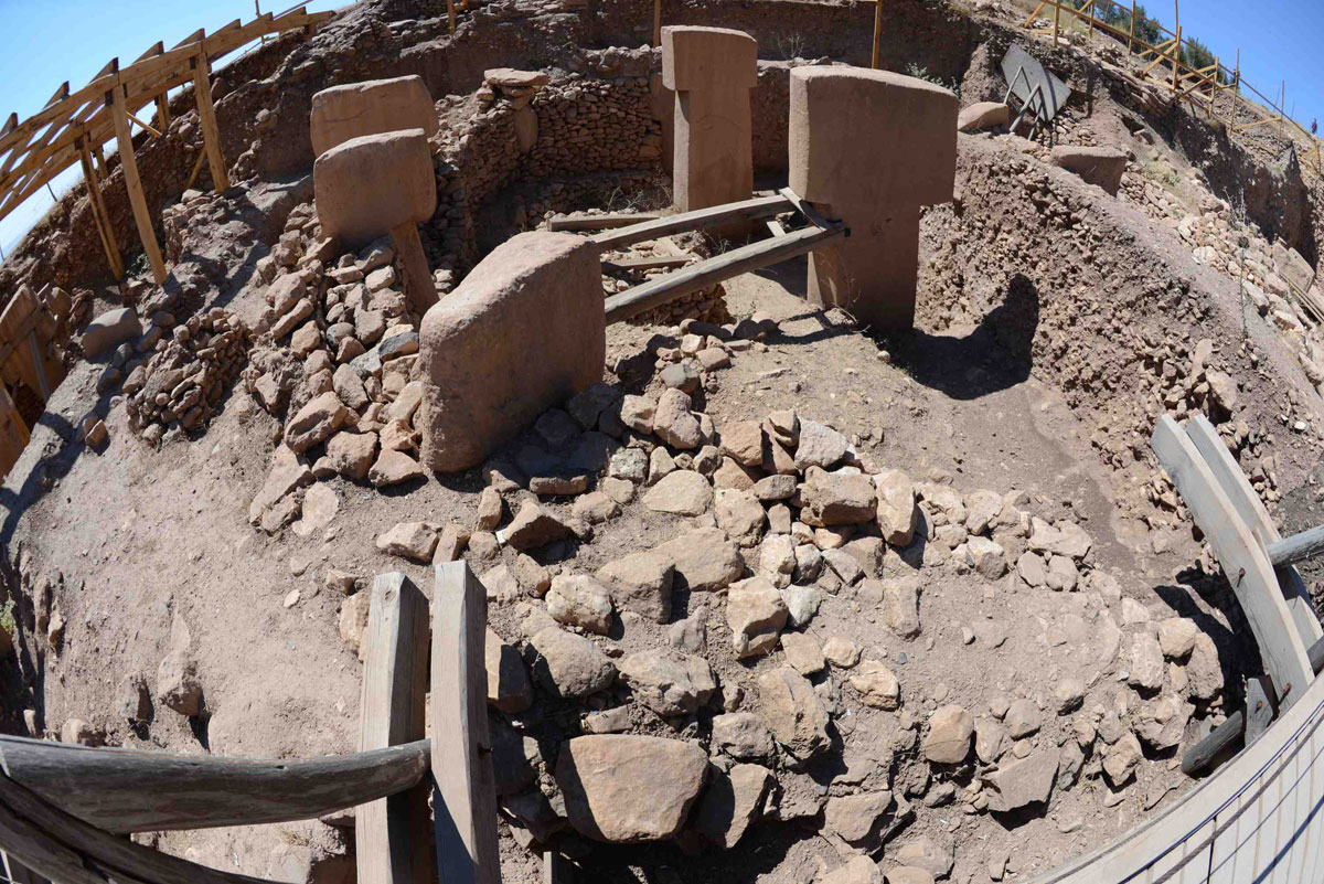
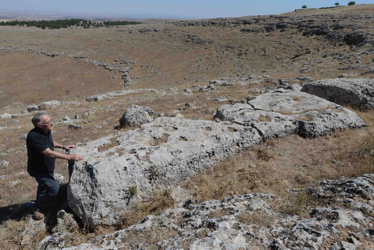
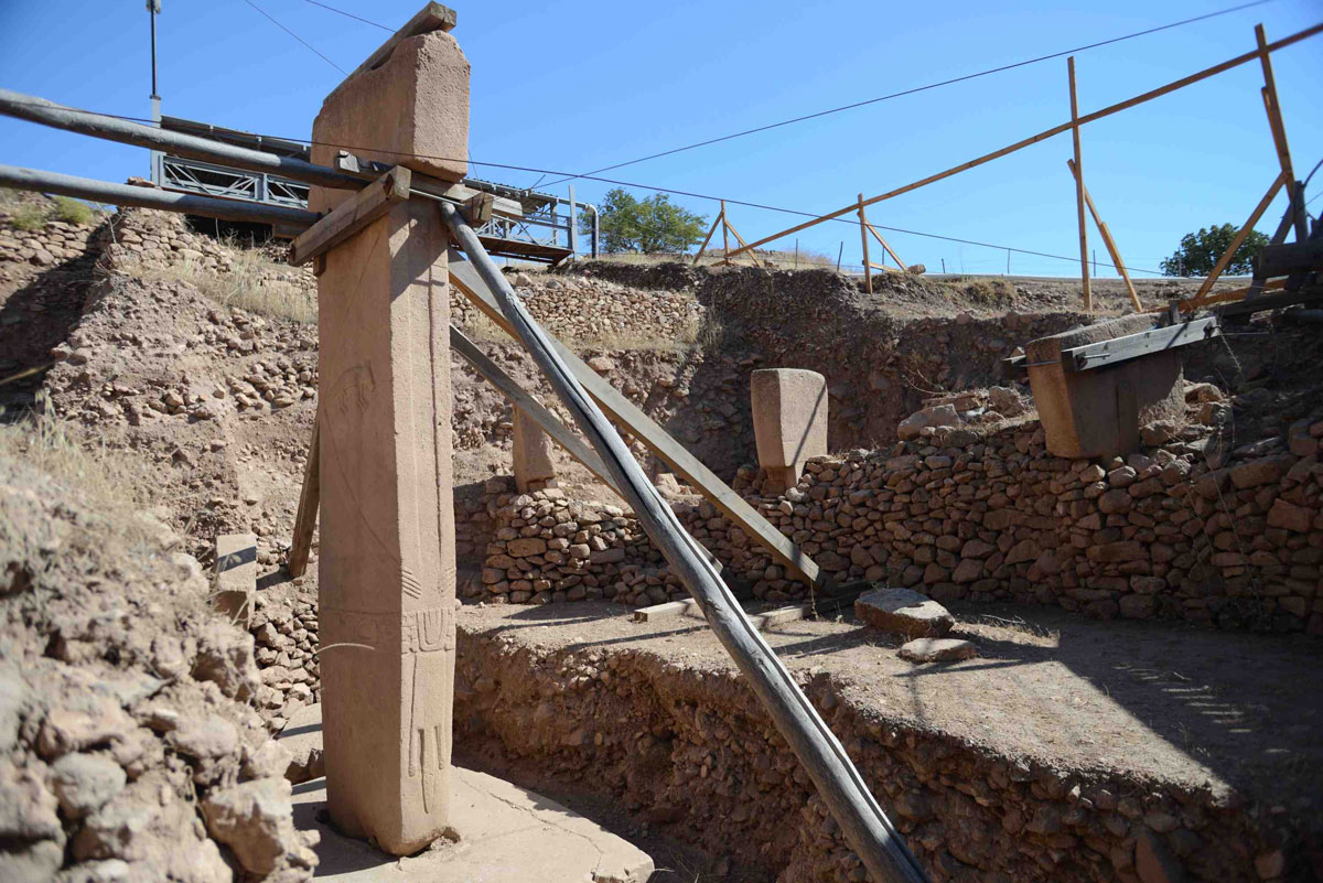
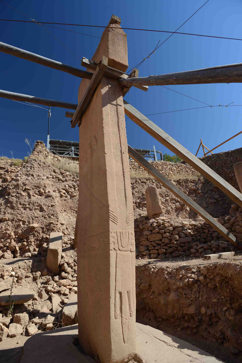
Gunung Padang is not the only ancient site that raises huge question marks over the story archaeologists tell us about our past. On the other side of the world, in southeastern Turkey, another man-made hill has been excavated during the past decade, this time by Professor Klaus Schmidt of the German Archaeological Institute. The site, called Gobekli Tepe (which means “Potbellied Hill” in the local Kurdish language) consists of a series of immense megalithic stone circles on the scale of Stonehenge and was deliberately buried (creating the appearance of a hill) around 8,000 BC by the mysterious ancient people who made it. The circles themselves date back to 9,600 BC, however, with the oldest work being the best. At least twenty further circles on a similar scale, identified by ground penetrating radar, are still deeply buried. Some of these, Klaus Schmidt told me when I visited Gobekli Tepe in September 2013, are likely to be much older than those already excavated.
At 7,000 or more years older than Stonehenge the megaliths of Gobekli Tepe, like the deeply buried megaliths of Gunung Padang mean that the timeline of history taught in our schools and universities for the best part of the last hundred years can no longer stand. It is beginning to look as though civilization, as I argued in my controversial 1995 bestseller Fingerprints of the Gods, is indeed much older and much more mysterious than we thought.
In essence what I proposed in that book was that an advanced civilization had been wiped out and lost to history in a global cataclysm at the end of the last Ice Age. I suggested there were survivors who settled at various locations around the world and attempted to pass on their superior knowledge, including knowledge of agriculture, to hunter-gatherer peoples who had also survived the cataclysm. Indeed even today we have populations of hunter gatherers, in the Kalahari Desert, for instance, and in the Amazon jungle, who co-exist with our advanced technological culture – so we should not be surprised that equally disparate levels of civilization might have co-existed in the past.
What I could not do when I wrote Fingerprints, because the evidence was not then available, was identify the exact nature of the cataclysm that had wiped out my hypothetical lost civilization, and this absence of a specific “smoking gun” was one of the many aspects of my argument that was heavily criticized by archaeologists. Since 2007, however, masses of scientific evidence have come to light that have identified the smoking gun for me in the form of a comet that broke into multiple fragments now known to have hit the earth 12,980 years ago. The impacts (some on the North American ice cap, some elsewhere) caused floods and tidal waves and threw a vast cloud of dust into the upper atmosphere that enshrouded the entire earth for more than a thousand years, preventing the sun’s rays from reaching the surface, and setting off the Younger Dryas deep freeze.
I believe it is possible that Gobekli Tepe may prove to be the work of the survivors of a great civilization lost during the Younger Dryas (interestingly the so-called “origins of agriculture” have been traced back by archaeologists to the vicinity of Gobekli Tepe and to the exact period in which Gobekli Tepe was created). But it is to Gunung Padang that I now look for a possibly even more stunning confirmation of my theory. Danny Natawidjaja’s geological survey has revealed not only deeply buried massive constructions and very ancient carbon dates at Gunung Padang but also the presence of three hidden chambers, so rectilinear in form that they are most unlikely to be natural. The largest of these lies at a depth of between 70 and 90 feet beneath the summit of the pyramid and measures approximately 18 feet high, 45 feet long and 30 feet wide.
Could it be the fabled “Hall of Records” of Atlantis? If Dr Natawidjaja’s geological excavation is allowed to proceed, despite strenuous attempts by local archaeologists to prevent it, then we should know the answer to that question, one way or another, by the end of 2014.
Note: GRAHAM HANCOCK is working on a sequel to Fingerprints of the Gods, provisionally titled Magicians of the Gods, to be published in October 2015 by Coronet in the UK, by Saint Martin’s Press in the US, by Kadokokawa Shoten in Japan and by Corbaccio in Italy.
Photographs
All Photographs by Santha Faiia: © Do not reproduce without permission from [email protected]
Click thumbnails for fullsize images
Gobekli Tepe


Gunung Padang


The US president raged at NATO allies over defense spending in meeting with the German chancellor, as Israel ordered its military to ‘advance’ in Lebanon
These discoveries are absolutely intriguing and are beginning to provide a look into our deep past as homo sapiens. Imagine if we currently held the knowledge that was possessed (and removed) from the Library of Alexandria. Keep up the great investigation Mr. Hancock – someday our descendants will appreciate the work you have begun.